For zoos, parks, gardens, festivals & campuses

Your venue map,
our technology

Turn the map you already have into a live guide with a 'you are here' dot. No app for visitors to download.

Less wayfinding work for your staff

Keep your own map

Visitors see the map you designed, with your branding and your layout, not a generic Google map.

Fewer “where’s the bathroom?” questions

Visitors can see where they are and find what they need without stopping your staff or front desk.

Update it in seconds

A closed exhibit or a new vendor is a quick edit, not a reprint. Everyone sees the change right away.

Nothing for visitors to install

They scan a QR code and the map opens in their phone’s browser. No app, no account.

Works with spotty signal

Once the map has loaded, the “you are here” dot keeps working even where cell service drops out.

See what visitors look for

Pro maps show which spots visitors tap most, so you know what people come to find.

Four steps, under an hour

Upload the map you already have, line it up, add your spots, and share a link.

  1. 01
    Upload your map Upload your existing venue map as a PDF, JPG, or PNG file.
  2. 02
    Line it up with the real world Line your map up with the real world, even if it’s hand-drawn or not to scale.
  3. 03
    Add points of interest Add clickable points of interest with fields for hours of operation, URLs, and category filters.
  4. 04
    Share it Share your map with a URL or QR code so visitors can use it on their phone.
Watch the full video →

Built for outdoor spaces

Help your visitors find where they are going or discover something new.
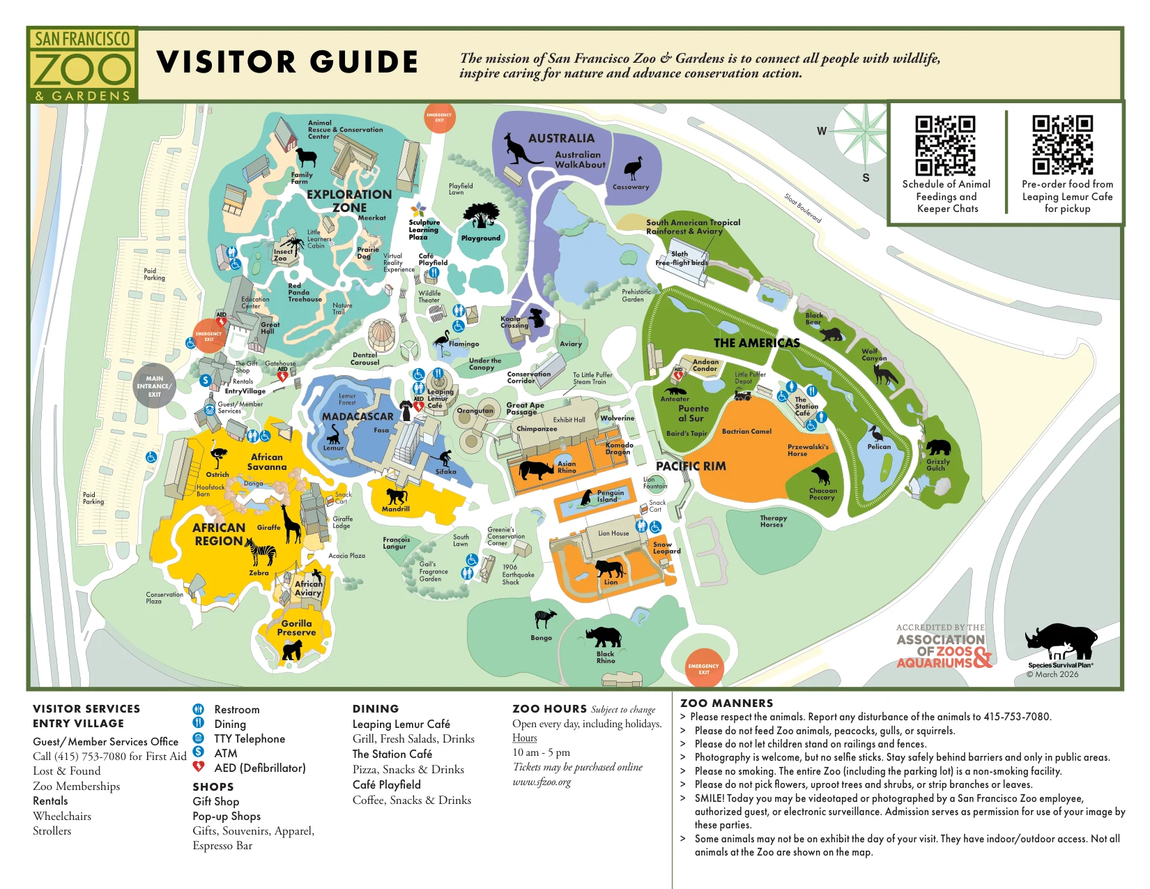
Zoos and botanical gardens map example
Outdoor Venues

Zoos & botanical gardens

Help visitors orient themselves instantly with a live 'You Are Here' dot. Add points of interest that invite them to explore more of your venue.

See live example →
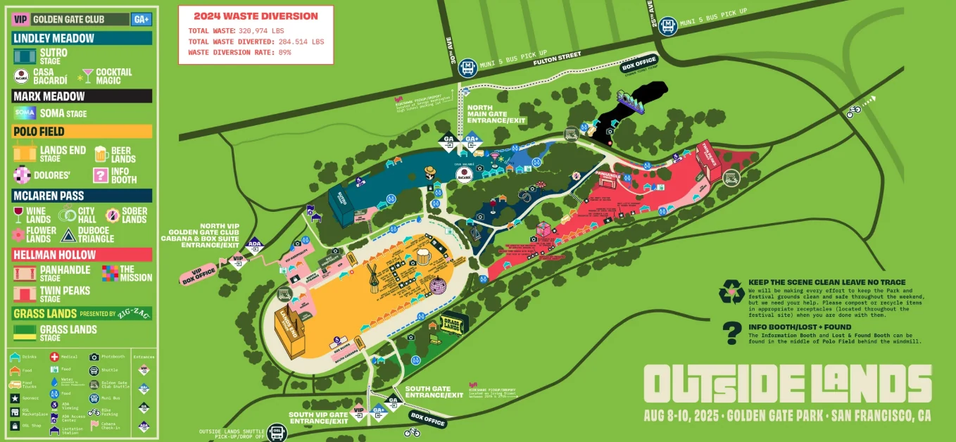
Fairs and festivals map example
Outdoor Events

Festivals, fairs & farmers markets

Show every stage, vendor, and entrance on a single shareable map. Add hours and categories so attendees can filter to what matters and never miss a set or last call.

See live example →
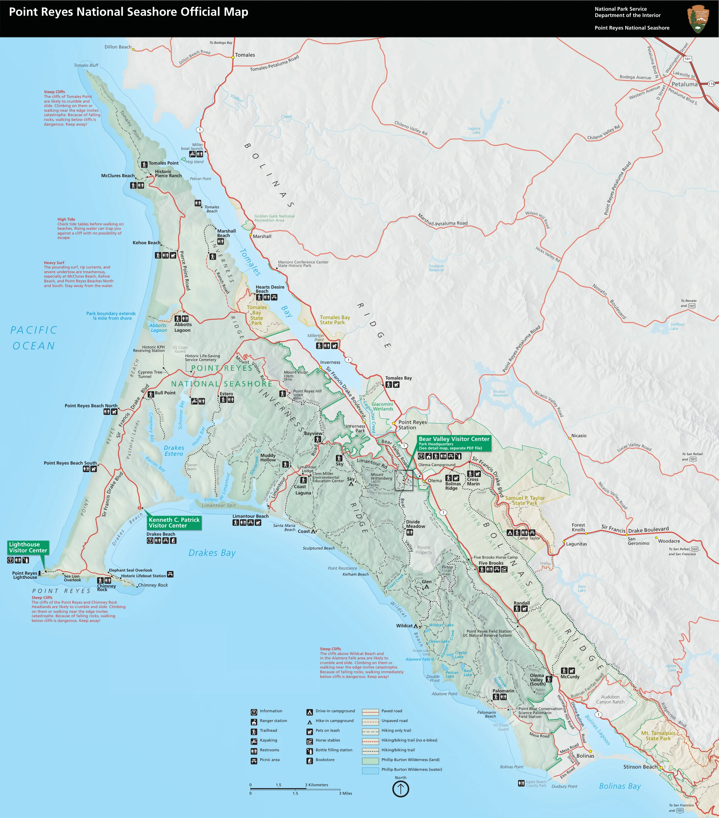
Point Reyes National Seashore park map example
Parks & Trails

Parks, trails & open spaces

Put your park map on visitors’ phones with a live ‘You Are Here’ dot, so hikers always know which way the trailhead is, even where cell signal drops out.

See live example →
Browse live maps from real users →

Start for free, no account needed.
Go Pro for scannable signage, teams and embeds.

Create unlimited maps free. Upgrade any map to Pro for QR waypoints on site, team editing, visitor analytics, and embedding on your website or app.

Free

$0
unlimited maps · no account needed to start

Create and share as many maps as you need. No account or payment information required to start.

  • Unlimited maps
  • Unlimited viewers
  • Live GPS “You are here” for every visitor
  • Edit your map anytime
  • Add interactive points of interest
  • Works offline, no signal required (once loaded)
  • Share via link or QR code
Start building free

Questions? Feedback? Get in touch →